


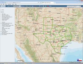
Public GIS Viewer (Map)

The Public GIS Viewer allows users to view oil, gas and pipeline data in a map view.
Technical Issues:
The RRC has identified the following technical issues with the Public GIS Viewer and neuDOCS. To fix these issues, we suggest you clear your cache and restart your browser.
- Viewing records in neuDOCS. For assistance, contact RRC’s Central Records at ims@rrc.texas.gov or 512-463-6800
- Using survey, lease and identifying wells search. For assistance, contact RRC’s Well Mapping Section at
rbamapping@rrc.texas.gov or 512-463-6851.
Public GIS Viewer
User Guide
Training Videos
The following training videos provide step-by-step instruction for new features of the Public GIS Viewer. The videos will open in a separate window, allowing you to toggle between the video and viewer.
Note: Some of these videos do not contain audio.
The Public GIS Viewer contains the combined functionality of the Legacy GIS Viewer and the newer appearance of the Enhanced GIS Viewer. In addition, the viewer has been improved with the addition of the following features and is updated nightly.
- Increased layer visibility options
- Dynamic legend
- Various basemap selections
- Different printing formats
- New measurement tools
- Consolidated identify tool and print functionality
- Various coordinate systems
- Consolidated pipeline, survey, and lease ID search
- Pipeline and survey search print functionality
- User defined radius tool
- Refined API search tool
- Combined point of Interest and address search
- Dynamic coordinates display
- Redesigned Web help and User Guide
- Reformatted Glossary
- Updated FAQs
- Revised Data Sources Table
Browser and Other Usage Requirements
- Mozilla Firefox 32.0+ and Google Chrome 37.0+ are recommended for the best viewing results.
- Internet Explorer 9.0 and below are not recommended.
- JavaScript must be enabled.
- Pop-up blocking in your browser must be disabled.
The Public GIS Map Viewers use pop-up windows to display details on mapped wells and pipelines. Disable pop-up blocking software while using this viewer. If you are not sure if pop-up blocking is enabled on your computer, try our Pop-up Blocker Test.
Contact Information
| Well Information | rrc.mapping@rrc.texas.gov |
| Pipeline Information | tpms@rrc.texas.gov |
| Production Data | productionreporting-info@rrc.texas.gov |
| Injection Disposal Well Information | UIC@rrc.texas.gov |
| LPG/CNG/LNG Information | SafetyNoticeReply@rrc.texas.gov |
| Drilling Permit Information | drillingpermits-info@rrc.texas.gov |
Public GIS Viewers Accessibility
The Railroad Commission of Texas (Commission) is committed to making its website accessible to all users. However, the inherent graphical nature of the Public GIS Viewers and the volumes of data represented make accessibility more difficult. The Public GIS Viewers use software written by ESRI, which currently does not meet the accessibility requirements outlined in Texas Government Code 2054, Subchapter M, and Texas Administrative Code, Chapter 206. ESRI has stated its commitment to meet accessibility requirements and continues to test its products for compliance. The Commission will continue to monitor the accessibility of GIS and the activity of GIS product vendors to improve compliance with state and federal accessibility requirements.
If you use assistive technology and the format of these pages prevents you from obtaining necessary data, contact the Commission’s Accessibility Coordinator by emailing accessibility_coordinator@rrc.texas.gov, calling 512-463-7229, or contacting us through Relay Texas. To enable us to respond in the most helpful way, please be sure to communicate the following: 1) the nature of your accessibility problem; 2) the format in which you prefer to receive the material; 3) the web address of the requested material; and 4) your contact information.
For more information on accessibility, please see our Accessibility Policy.
Support Resources
- To obtain records for well depth, plats, well location contact Central Records at 512-463-6800 or via email at ims@rrc.texas.gov. Records retrieval requests may be subject to charges in line with the Natural Resources Code and Texas Public Information Act.
- For API questions, well detail discrepancies in mainframe, well name only issues in the Public GIS Viewer and when RRC corroborating documentation is required contact RRC.Mapping@rrc.texas.gov or Production at 512-463-6726.
- To request changes or updates to well locations contact Well Mapping at RRC.Mapping@rrc.texas.gov.
- For questions or inquiries regarding survey names, abstract numbers, survey/subdivision construction issues contact RBA Mapping via email at RBAMapping@rrc.texas.gov.